With only a couple of days left till I fly to the USA to take on the Pacific Crest Trail I should be focusing all my effort on gear and prep and last minute chores, but no. What am I thinking of? Toothache.
Last Friday I started to get some mild soreness around my gum and by Sunday evening the pain was ghastly. Luckily, I was able to alleviate the pain with Ibuprofen, and get an emergency appointment this lunchtime, which established the problem was an abscess around an old bit of tooth left after an extraction ten years or more ago. This is a big relief, as it proved possible to drain the infection and hopefully with antibiotics clear thing seup, at least enough to fly and see what happens.
I had horrific scenarios in my mind on the scale of fracking for natural gas, but it turned out to be much serious. The dentist even laughed when I warned her she was more likely to be doing archaeology than dentistry in my mouth. Fingers crossed it doesn't bother me too much when I'm hiking, but at least there's a dentist every hundred yards or so in America. I checked on the internet, and there seems to be one at even the smallest settlement, so with luck I will be able to handle anything that comes up!
Monday, 13 April 2015

Tuesday, 31 March 2015
What is the Pacific Crest Trail? [pt2]
The early section of the PCT is relatively low altitude starting at 2915 ft, rising quite gradually to a peak of about 9000ft until one reaches the High Sierra where altitudes exceed13000ft in one or two places. It is possible to take a detour to higher ground if certain mountain summits appeal to you, but the highest actual trail point is Forrester Pass at 13180ft. Inconveniently, this is about 29ft over the typical limit for most travel insurers, and one I called told me I'd have to insure myself for exceeding that altitude, over the duration of the whole trip, even though I'll probably be over the pass in half an hour and back under the limit.
The desert, is also the habitat of crotalus atrox,
or the Western Diamondback Rattlesnake. Its not the only rattler
though - there are many other varieties and most of them live in
abundance here. You may walk a week without seeing or hearing one, but
then see five in a hundred yards. They are potentially deadly
poisonous, and can bite multiple times and lightening fast in a second
or two. I say potentially as about 7,000 - 8,000 people are bitten per
year in the USA, but fatalities number in the single digits. The good
thing about them is they are not stupid, and when some lumbering hulk of
a hiker comes barreling down the trail towards them, they know he is 50
times their size and could kill them, and immediately start warning of
their presence with the rattling-tail gag. This is a good thing -
no-one ever died from hearing a rattlesnake. so as long as you stay
alert, don't step over something where you can't see the other side,
poke your hand into bushes or under rocks and so on, you will be highly
unlikely to get too close to one, and therefore never get bitten. Few
rattlesnakes exceed 4-5ft, and can strike about half their body length,
so if you walk six or seven feet round the snake, its not going to reach
you even if it did try to strike.
Occasionally,
a lazy or stubborn one might sit in the middle of a path,refusing to
move. If lobbing rocks at it doesn't see it off, you may have go round
it, if that's safe. Its pretty stupid to muck around with such a snake
though, so best not to go poking it with a hiking pole or what have you.
Most snake bites happen because people are interfering with the snake
or trying to handle it - so the trick is, don't. If I met a snake in a
confined gully, I would be only too happy to take a short reverse detour
if possible, or settle down for a cuppa a few yards back until it
buggered off. What I wouldn't do is piss it off.
Other
hazards include scorpions, which of course have a stiong on their
articulated tail - apparently, the ones with big claws are generally not
very venonmous, whereas the ones with little feeble claws tend to be
VERY venomous. Scorpions are nocturnal, so my plan is to keep my shoes
and socks inside my tent when I remove them, and then I know there ain't
any hitchhikers to shake out next morning. Even the most venomous
scorpions rarely cause fatality to a fit person, but the sting is
ghastly and painful from most of then, so best avoided.
The
bigger animals to be aware of are bears, black bears, (which are not
always black - sometimes brown). They are powerful, physically big
animals, but seldon aggressive, and more likely to hurtle away at pace
if you encounter one. A juvenile might be curious and follow a hiker
hoping for food, but my feeling about bears is I will be pleased and
excited to see one. It would be foolish to assume that there is no
danger from bears though, and in some sections of the hike, especially
the sierra there are places where bears have become familiar with humans
and may come close, so close control of food storage is required to
reduce their dependency on being near humans - this has become such a
problem that bear-proof canisters are mandatory in places. In parts of
Canada and certainly Alaska, the Grizzly bear (or what Native Americans
called the "real bear") is common. These buggers are a whole different
kettle of fish and I would not want to meet one of those much.
Then
there are Mountains lions, also known as cougars, or puma. These big
cats are common through the whole of North and South America. They are
not as big as African Lions, being slightly smaller than a Jaguar or
Panther, but still capable of killing a man. In fact there are rising
numbers of attacks in the last two decades with some 20 deaths or so,
which is twice as many as in the previous century. This is because of
rising numbers of human visitors to their territories, although nearly
two thirds of these fatalities were children. On the whole it is
unlikely that you will be attacked by a mountain lions, as they usually
don't recognise humans as prey, but a cornered or very hungry cat might
be more aggressive. I really hope I get to see one, but they do say you
are a hundred times more likely to be seen by one, than see one
yourself.
I'm
saving the worst till last obviously. Mosquitoes. Little bastards.
Like tiny single engined aircraft whining around looking for someone to
bite. In the summer in the Sierra, where water is everywhere, so are
the mozzies, so its long pants, long sleeves, head net and bug
repellent, and maybe you'll get away with out too many bites. But, you
WILL get bitten and sometimes they are as thick in the air as smoke.
I'd sooner meet a pack of wolves.
Presuming
one is not inconvenienced by any of these creatures, the walking will
be tough, depending on how fast or slow you take the journey. The thing
is, you can't be too slow because of the weather.
Most
people start in mid to late April, and indeed there is a big 2 day
kick-off party about 20 miles up the trail at the end of April. Start
any sooner than this and you risk getting to the Sierra Nevada while
there's still too much Nevada going on - snow. And it can be many feet
of it. Too late, and the desert will be getting hot and dry, the melt
water in the creeks in the Sierra will be raging torrents, and you may
not get top the end of the trail before the snow starts falling for next
year in Washington. The journey takes most comleters about 5 months.
My plan is to do it in four and a half, starting from Campo on April
18th and hopefully crossing into Canada on or before 31st August. I will
fly back from Seattle on September 2nd.
If
I make it, and that is far from being a gimme, as I am fat, fifty one
and have a bad left knee, I will almost certainly lose a significant
amount of body weight. Some people lose a third of it or more. I
consider this a plus, but any thru-hiker knows that their relationship
with the trail largely boils down to food. Its common for resupply days
to be about obsessive laundering, blogs, restocking the food for the
next week's walking, and as many meals in town as its possible to cram
in....three breakfasts, two lunches, maybe a couple of dinners. Its
basically impossible to carry enough calories to replace what's being
burned off, so resupply days are very much about gorging to compensate.
Monday, 30 March 2015
What's the Pacific Crest Trail? [Pt1]
I'm always moaning on about the PCT and how marvelous it is, but it just occurred to me, that not everyone knows what its about or where it is! Well, here's a picture of it. You see that thin red line meandering up the west coast of the USA? that's it; that's the PCT. A strip of dirt two feet wide and about 2660 miles long. That's some path. Its generally attempted as a northbound trip, but annoyingly, its not always heading north, and even sometimes goes quite seriously south.
It starts at the Mexican border near Campo, a border control settlement, and winds up through California, Oregon and finally Washington; terminating at the Canadian border. Lack of roads at the northern terminus means most hikers walk on another 8 miles to Manning park in Canada, and get a bus to civilization to return home. As well as being long, there's a lot of up-ness and down-ness, about 498,000ft of each, which is the equivalent of ascending and descending Mt Everest (from sea level) over 17 times. That is serious.

So, it IS a long old path, but its hard going in places for more reasons than distance. For example, the first 500 mile section is in the Mojave desert, which is a scrubby desert, rather than the sand-dune kind of thing you might imagine when you think of the Sahara. But that doesn't mean its not hot - it can be roasting and carrying enough water to get from A to B is a major undertaking. Most people need about 5l of water a day to be reasonably well hydrated, but that varies from person to person a little. You really don't want to get dehydrated in the desert heat - not just because you feel thirsty, but because you will eventually inhibit the body's ability to sweat and once that stops, you are in serious risk of heat-stroke where the body cannot shed heat fast enough, and overheats, possibly fatally. Planning your water consumption and sources is therefore very important. Its not a completely dry desert, and there are creeks and springs in places, often dry by the middle of summer, but in April, potentially still viable water sources, and on top of that, settlements, cattle troughs and sometimes water caches left by volunteers. Water caches are coming into disrepute lately because of the trash they cause. They can be a godsend of course, but I wonder if one ought to try not to expect them, and/or plan around them, simply because they are not obliged to be there and dependency on them becomes risky. On the other hand, if I happen on one, will I fill up with water? You bet your skinny, bone-dry ass I will.
Wednesday, 7 January 2015
Book Review: Chris Townsend - Rattlesnakes and Bald Eagles
 Chris Townsend - Rattlesnakes and Bald Eagles: Hiking the Pacific Crest Trail - 2014 [Sandstone Press]
Hopefully reader, you are familiar with Chris Townsend - one could hardly be unaware of him if at all active on the UK walking scene, such is his longevity and credibility as a commentator on matters of long distance hiking, wild camping, equipment and techniques to name a few. Recently he has even become quite the 'luvvy' featuring centrally in two of Terry Abraham's films, and with cameos in others - I'd actually seen some gear features on Youtube before I ever read any of Chris's books, so by the time I did, they read in his voice. Happily, he remains active as a writer, blogger and columnist on the outdoors, and has written many books about his travels, and on the techniques and paraphernalia we all obsess about.
His most recent book gives an account of his walk on the Pacific Crest Trail in 1982, a time at which "thru-hiking" was a fledgling concept and the trail attracted a few dozens of hikers compared with the hundreds and thousands who attempt it today. By that time, Townsend was an experienced walker, having completed a trip from Lands end to John O'Groats, but admits in the book that he was naive about the demands and hardships he would encounter on the PCT. One incident that presaged walking practice today was his abandonment of heavy boots almost immediately the walk began in the desert, preferring to wear his running shoes that were only taken for camp comfort. He returned to the boots in the snowy High Sierra, but finished the walk in a pair of what we would now regard as approach shoes much against supposed expert opinion at the time. If you read any account of the PCT today, you will find no-one wears big boots, especially in the desert; and it's insights like this that give the impression he was as much sculpting the way hiking would be done in the future as enduring the walk in the moment. I don't suppose he thought of it in those terms then. Most of the adjustments and compromises he made seem to have been a matter of accelerated evolution as a walker learning on the hoof what wasn't working and how he could deal with it.
Real testament to his spirit and toughness then that he was among a relatively few completers that year. The PCT association's website records as few as 11 people finishing the walk in 1982, whereas the total for 2014 was 371 - notwithstanding that some names may be missing.
Townsend compiled journals throughout the trip upon which he has been able to depend in recalling detail of individual days - his thoughts and actions revived after more than thirty years, lending the book a feeling of documentary that teaches us more about today's likely experience than a simple account of a walk undertaken last year would do. We already know about Goretex and meths stoves, trail magic and bear canisters - what this book does is strip away the necessary but distracting ephemera around which we plan long distance trips today (I know because I am already making gear lists for my attempt in 2016), and gives us insight into the environment, the effort involved, the reaction of people he met, and perhaps most importantly, the impression it made upon him, shaping his life and career thereafter. On his website, there is a tab detailing the major walks he's completed up to about 2002 (probably needs an update - at least the Scottish Watershed walk is missing). He makes a major trip every three to four years in the sequence, some of them astonishingly ambitious to my eye, and one wonders if he would have dreamed of doing any of those if the PCT had been a disaster.
For those who might aspire to trying a long distance hike, on the PCT or anywhere else for that matter, you would do far worse than read this book. Its often said that state of mind and determination are the most vital bit of gear you need and weigh exactly nothing, and this above all is what comes over. I think back to one amusing passage of indignant comment he makes concerning a hiker who is roundly suspected of fibbing about how much actual walking he'd done. He points out that its nobody's business how much or little of the walk one actually treads - indeed there are probably as many or even more 'section hikers' who do a little bit here and there than thru-hikers - but to lie about what you've done is just disrespectful to others who have put the sweat in.
It's indicative of the simple honesty of using one's own two feet to cover long distances that is at the centre of all of Townsend's books, and this one is no different, but it has one extra quality that makes it important. It amounts to a walking manual - not a gear manual or a backpackers guide (he does those too!), but a manual on how to walk, think about walking, how to stop and not walk at times; and what you might get out of all of it.
Recommended.
Tuesday, 6 January 2015
What's the plan for 2015?
I can't read "2015" without wanting to say "A quarter past eight" because I'm a nerd. I suffer for it, but it comes in handy weighing stuff I might put in my backpack, that nerdiness does.
However, nerd or not, 2015 is upon us and I need to start thinking what I'll be doing this year, especially as it's the year I will be getting ready for the big trip in the USA next spring - the Pacific Crest Trail. That is unless my employers get the arse when I tell them I'm leaving in just over a year, and fire me. In that case I'll do the PCT this year and panic like mad with only a few months to get ready. That would make any plan for 2015 go to cock.
But let's assume I am in Blighty MOST of this year....
- Well, firstly, I plan to record all my mileage this year, and I've downloaded an app to do so called "Walk log". Fiendishly clever name that. I am currently on 32.4m, all on the flat or nearly so. I reckon there's about an eighth of an inch of total ascent to report. I'll be doing a lot of miles locally on the flat this year to pursue my project of changing myself from John Falstaff to John Hazelstaff. In addition to that, all my proper walking will be logged, and I'll be ramping up the distances as the year goes on in prep for 2016.
- Next, I have a bunch of Wainwrights still to do, albeit mostly the smaller ones now, excepting Scafell and Slight Side. I think I have 56 left to do and I think I can get those polished off in the next twelve months. To realise this I will do a lot more wild camping this year so I can complete the list in fewer trips and make the bagging a bit more efficient. Some of the ones I have left are dreary and in some cases isolated having given up on walks during bad weather etc. one of those is Raven Crag overlooking Thirlmere. Sometimes it's nice to have a weekend mopping this kind of fell up. I did five or six last autumn on a Saturday just driving between them and scooting up and down quickly - like Binsey, Little Mell Fell, Great Mell Fell and so on.
- In mid to late April I may do a longish 'week' of desert training in the Mojave, perhaps getting 100 miles under foot. I will be hiking at the same time as the 2015 PCT crowd, so I get a realistic feel for the heat and water issues at the same time of year as I will be setting out for real in 2016. This will be tougher than the real thing as I will not have lost all the weight I will have over a year from now, but that simply means it will be a bit easier in 2016.
- Back home again, I want to take one of my dogs on the Coast to Coast walk. I have three dogs, two of which are very doughty, a West Highland terrier cross Maltese (...so a highland Malt!) and a Field Spaniel. The Spaniel is still a pup at only 6 months, so he will be approaching a year by then. I think he will have the legs for it, and I will find out more on the fells this Spring. The Westie, Jocky, has never given up on a walk with me - he's done about 65 Wainwrights - and seems to just keep going, but I wonder how he would cope day after day. I think he would be fine, but maybe I'll start training him a bit. The third dog in case you wonder is a lovely little cocker cross toy poodle. She's tiny. Actually she's done about 25 Wainwrights so she's far from idle, but I just don't think she'd really keep up the pace if we took her. Anyway, she's a lady and detests the rain. Funny dog - loves a bath and actively seeks out rivers, ponds and mud holes. But hates rain.
- I'd also like to do the Dales way this year, but pressure on holiday days from work might dictate I try to do the whole thing at an all nighter. It's about 36 hrs at my kind of pace with stops, but lots of people have done it and it would be a great challenge.
- ....erm. That's it. Oh, no it's not. My wife demands that I take her up the miners track. That didn't come out right. She wants to climb Snowdon, so that will probably be a weekender with all the dogs, or possibly a short week trying to knock off the Welsh 3000's. I've only done Snowdon, so it would be pretty good to do some of those.
 Posted with Blogsy
Wednesday, 31 December 2014
Preparation preparation preparation!
Just that word repeated three times puts me in mind of Ben Kingsley playing Don Logan in Sexy Beast.
However, I am referring to my preparation for the PCT in 2016. Seems a long way off, but I will have to let my employer know about it before long - especially as I would like to begin fundraising midway through 2015, and if that scares the horses, I don't want to be out of a job for many months before the walk. My thinking is that I tell them straight after New Year that I will be leaving in a years time or so, and if they get the arse, I'll leave straightaway and do the walk in 2015 instead. It gives me less time to get ready, get fitter and so on, but I could still do it at a pinch.
But, there is a huge amount to plan, so onwards and upwards...
Tuesday, 30 December 2014
Looking ahead to the Pacific Crest Trail 2016
So, I've made the decision that I will hike the Pacific Crest Trail in 2016. I'd love to do it in 2015, but I am in no shape to take it on, and have not done any prep yet, other than a bit of thinking and a few mappy things, so I feel I should be more prepared.
There are three stages to doing the PCT...
1. Deciding you're going to do it.
2. Really deciding you're going to do it.
3. Doing it.
I've been in love with the idea of this walk since I read Chris Townsend's book about his walk on the Arizona Trail. That is a shorter, but seemingly very tough walk (Arizona is modelled on Mordor in places) which got me thinking about long distance trails. I then became aware of the PCT and the Continental Divide Trail; read some of the books written by thruhikers and finally got round to to Keith Fosket's book "The Last Englishman", and soon thought I'd like to be the next Englishman!
Recently, a film has been released dramatising the book "Wild:A Journey From Lost To Found" by Cheryl Strayed. In her book she describes her experiences hiking the PCT or a good part of it, following some personal difficulties leading up to her adventure. Its a decent read as a personal story, though not much in the way of a hiking manual (she makes nearly every mistake imaginable, but toughs it out nonetheless even if she consciously concludes the walk at the Oregon-Washington border). Perhaps surprisingly, and to her credit, the author manages to come over as likeable despite setting up a rather unsympathetic account of herself and her behaviour. In fact her candour about the adventure has earned her some negative reactions, which seem to be based on either exaggerated or ignorant conclusions about her. The film stars Reese Witherspoon as Strayed, and has provoked good reviews - I haven't seen it yet as it is to be released in the UK in January 2015, but people are talking about Oscars so I'd like to see it and make up my mind. One negative review described it as a feature length selfie, which I hope is off the mark, but we'll see. When I first read the book I did feel it conveyed the feeling of "Look how wonderful I became when I rehabilitated myself", but subsequent comparison with other books reminded me that Strayed's writing manages to deliver sentiment without sentimentality which I think is important.
I confess I am worried the film might inspire a legion of fashion hikers thinking they can just get up and go - any exposure on TV or film for a sport or activity seems to create a brief flush of mad enthusiasm for it. You only have to try to book a public tennis court during Wimbledon to know this, but walking 2650 miles is a more serious undertaking. I visualise lots of clueless hikers setting off into the Mojave desert with one pint of water and running screaming at the first sight of a rattlesnake. Maybe I am underestimating people's common sense, or overestimating the reach of the film, but I go walking for peace and a certain amount of solitude, so I wouldn't be delighted to see the trail become too busy. My hope is that it will have died down a bit by 2016, though numbers on the PCT grow year on year regardless. When I reflect on the many thousands that walk in the lake district and how few people one sees on many fells, I can see an argument that the extra numbers will not be a problem. On the other hand, there are some aspects of trail life which might be destroyed by a big surge in hikers - not least the fragile world of "trail magic" - favours offered by strangers for no reward. Such generosity is to be deeply appreciated but never sought, and I wonder how fatiguing it could be for the kind souls who become known as "Trail Angels" to suddenly face thousands of demanding people. I hope its a future I don't see realised.
On the matter of potential crowding, hiking guru Chris Townsend suggested to me leaving early or late, or even doing the North to South route. He's right of course, but at this stage I don't know how much flexibility I have for the start time, with the well known issues of snowfall in the Sierra Nevada and the Northern Cascades. Basically, if you leave too early from Campo, at the Mexican border, you risk getting to the High Sierra while there is still lots of snow from the previous winter. This could slow you down significantly, or even make the walk impassable and force you to wait for weeks - which obviously defeats the point of starting early. On the other hand, if you start late, the High Sierra might be clear, but melt water could be an issue in some creeks running off the Sierra, and you also risk encountering next Winter's snowfall further North in Washington state, which has the potential to curtail the hike completely.
The ideal would be to start late, and walk at such a pace as to get to Washington well before the snow starts to fall. Plenty of people do that, but they hike at a hell of a pace. At my currently level of fitness and endurance I doubt if I would average much above 18 miles per day, even if I will do some 30 mile days at times. And you have to factor in the "zero days" which one must take in towns near the trail to resupply. From what I read, this is as often as weekly for many hikers, but occasionally longer on some sections. I'll have to make a detailed resupply plan, and work how many days that represents and go from there. If I conclude I need to average over, say, 25 miles a day then I will have to train up to that for the early section. After a month or so, I imagine I will be as fit as I'll ever be, but the first section of the trail is in the desert, which is bound to slow things down, and I'll be getting my trail legs too. I read in a PCT blog recently that an important early lesson to learn is that you don't have to get from Campo to Lake Morena in one hop. Its the first 20 miles and many set out determined to be there for the first night's camp. If that works for you comfortably, then fine I guess, but the point was you really need to listen to your body and settle into the walk if you stand any chance of getting to Canada. This makes good sense to me, and I do not see making my feet into burgers as a great way to start the trip. I'm hoping I can prepare well enough that water and heat will be the big challenges rather than trouble with feet. I can only recall ever getting one blister in the past which I treated with a Compeed, so maybe I have the knack of getting footwear right. The unkown I need to better understand is that of distance versus the weight of water its necessary to carry. For twenty miles, with a camp at the end of it, I can see how I would be starting out with 6 litres or more. In the desert it is now common to find caches of water left by "Trail Angels" - former PCT hikers who voluntarily provide various conveniences, luxuries, supplies and assistance on the trail, completely for free. I feel its risky to depend on water caches unless you leave them yourself and hide them well enough to be sure they are still going to be there. I think Chis Townsend may have cached a few places in his Arizona Trail hike, which is even more brutal on water use, but I'll have to check. Anyhow, the point is, to be safe, you have to carry lots of water, which affects your speed and distance. If we do see a big increase in hiker numbers in the next year or two, the pressure on water caches will be severe, and put the emphasis on starting early to be ahead of the pack.
The notion of hiking North to South needs more research as I hadn't seriously considered it, but my initial reaction is that its a completely different project to the South-North approach. It makes dealing with Snow a different proposition as the late start from the North must begin when you can comfortably navigate whatever is left on the ground, and its likely you will get to, and past the High Sierra before the next snows, leaving the desert till last. However, the desert section would be horribly dry by the end of the summer, making dependency on water sources a bit patchy. I hear that many hikers of the Continental Divide Trail walk North to South, and encounter this issue, though that trail is a bit longer and perhaps it necessitates the North-South route.
I may do a week in the summer of 2015 in Arizona or Nevada to get a feel for this. There are actually some good hiking routes near Las Vegas in the Mount Charlston area, which would be easily accessible and plenty hot enough, or I could even do a hundred miles or so of the Mojave from Campo to try it out. If I find I am going really slow, its no risk to the eventual walk, and I can factor it in my plan. I did a little walking in Canyonlands, Utah last year and it was pretty hot. I drank a litre of water in about two hours, and could have drank more - perhaps should have, but to be fair I had no real walking gear with me, and we stayed within two or three miles of the visitor centre on well marked paths, so could have walked out even with no water at all. The real deal will be very different, and not to be underestimated. I'm no camel, but I do find it possible to tolerate lack of water for a while, yet even the hottest days here are nothing compared to the desert. I've been to Death Valley three times, and experienced crushing heat, although the hottest I ever experienced was in Arizona when I visited a native American archaeological site a couple of years ago. The heat was so intense, it felt as though the nearly silent desert was "buzzing" - like Tinnitus. Its hard to explain, but other hikers I've mentioned it to have agreed on the illusion of being able to "hear" the heat.
Lately, I have noticed some soreness in my right knee when walking more than seven or eight miles on the flat, but its never a problem on the hills, so I conclude its an issue of my weight constantly bearing down on the same point of the joint - it goes away after an hour or two. I think weight loss will fix this more than anything else. I have a plan to monitor this over the next six months or so, and lose weight accordingly. I have some Wainwrights left to do - about 60 or so, and will be walking the English Coast to Coast path next Summer, so this will give me some indication of any problems I might need to consider. Funnily enough, they say don't start the PCT too skinny. Basically, its hard to carry enough food to make up for the energy you burn, and people lose a lot of weight walking the trail. Good.
I will have to give up work to do this, for which I can budget, but I need to work up to this with my employer. Who knows - they might keep my job open for me, but I am assuming not.
Also, I plan to try raising money for Mountain Rescue so I need a bit of a run-up to that if its going to be effective. I want to split whatever I get between the England and Wales MR and the Scottish MR. I haven't yet done any walking in Scotland, but I will one day, and I've seen enough of their terrain to know it is not to be taken lightly. I'll write more about Mountain Rescue in another post so I can direct potential sponsors to it in the future.
Monday, 4 August 2014
Back from Lake District
Last week the wife and I, along with our two dogs went to the Lake District, staying at The Travelers' Rest near Grasmere. For the first few days the weather was pretty good, even hot on Monday, but it deteriorated as the week went on, with fairly heavy showers on Friday although that was the only day with no respite. Oddly, our room in the hotel was absolutely tropical throughout and we slept with a big fan blowing, and the windows open. Not sure why it was so hot there, but had I known, I might have chosen somewhere different. The Travelers is a funny place - benefitting from a great location, and seemingly very well presented, but the place is not really very comfortable in some respects, with lumpy beds, no armchairs etc. It is saved by the lovely staff who are mostly foreign, Romanian, Spanish etc and who make the difference. I must say I have been using the Travelers and its sister Hotel, The King's Head at Thirlmere for about three years now, particularly as they are very dog friendly, and the menu is becoming a bit tired - and its not always that brilliantly cooked at the Travelers either though it seems to depend on the dish. Anyway, I suppose I will stay there again, but if I'm honest, it was a bit if a struggle for a full week.
We did a little walking, though less than I hoped and I can tick off another three Wainwrights, having climbed Seat sandal with Leigh and the dogs, which I found a struggle as it was so hot. Leigh got to the top before me - when I didn't appear for ten minutes, she went looking for me, and headed along the North wall, whereas we had ascended by the East wall, so when I went looking for her, she couldn't understand how I'd got to the top without her seeing me. Her sense of direction and navigation skills are zero, so I need to help her become more familiar with maps and GPS etc. On Thursday, Jocky and I went up back o' Blencathra to climb High Pike (Caldbeck) and Carrock Fell. These were a real pleasure to climb and a nice breeze kept it cool enough to enjoy as the sun was out for the late afternoon - we started at about 4pm and got back to the car at around 7.40. It was nice starting late as we saw only a glimpse of one person the whole walk.
In other news, I have more or less decided now that I will attempt the Pacific Crest Trail, probably in 2017 if I can work out the financing of it - and bearing in mind I will need to leave work to do it, and hopefully get another job when I return. That is not to be sniffed at. I am in terrible physical shape right now, so this is a great way to get back to some sort of fitness in preparation for the walk.
I will make occasional posts about this as things proceed.
Monday, 24 February 2014
MLD Trailstar guy line slips - how to secure the lines with the standard line locks
Before Christmas I treated myself to a tarp - the Mountain Laurel Designs Trailstar which is said to be a marvelous tarp and the best thing since the last quite good thing.
I pulled a face therefore when I read on the internet just now of a catastrophic trailstar collapse event, by a fellow wild camper up Helvellyn in, shall we say, more than a light breeze. Basically, he trusted the line locks provided with the tarp, and they slipped making his tarp collapse and letting him down like pair of cheap Japanese braces. He wasn't injured, and had a back up bivvy. But in the process the tarp got torn and he swore a lot. No, I mean a lot - I saw the video he made from his backup bivvy. He was indignant to say the least. No it was worse - he lost some kit to the wind. Titanium kit. This is unacceptable and I panicked as I haven't even tried my new tarp out yet. Checking a few other blogs, it seems the standard locks are known to be a bit suss when using thinner cord, but should be OK, with the 3mm supplied. Well, evidently not, so I thought I'd have a look at this before venturing out with it.
I've examined the line locks and I think there's a couple of things to try before giving up and getting some other locks. I've taken some pics to explain.
Here's the normal layout with the loose end of the line at the top and the tensioned line at the bottom, below left. You can see that the loose end goes up through the rear hole of the line lock, over a plastic bar and down through the front hole. It has to be be this way round as explained in the third picture.


And here's a closer look. On the left you can see the v-groove, indicated with the screwdriver tip, in which the two sections of the line sit under tension. The loose end is in the bottom of the groove and the tensioned end presses down on top of it (or technically underneath it as these photos show the underside of the lock), and this is how the tension is maintained when all is well, but if the wind is buffeting about and blows the tarp in such a way that the tension is reduced briefly, the loose end can begin to slip (as per the right pic because there is nothing pressing down in the groove. Our hapless friend with the collapsed tarp thinks the friction of this system may have be overcome by strong gusts, but my guess is it was more to do with momentary release of tension that started things off!
Then when the wind stops the slack introduced will stop the tensioned end gripping the loose end and everything gets worse quickly, and all your pans blow away!


So, how do we deal with it? Well the first trick is to take the loose end of the line and yank it back towards the tarp (see below left) so it doesn't sit in the V, and let the tensioned end sit in the bottom of the V. Then what happens is the loose end of the line jams against the side of the V groove channel under the pressure of the tense line (see below right - loose end indicated by screwdriver agin). This is a pretty solid arrangement and doesn't lose its locking effect if the tension is momentarily lost, but I don"t know how it will be affected by moisture, and I wanted more security....


So, I found another way to arrange things. Firstly, peg out and tension as normal. Then grab the two line ends, between the peg and the lock, with your right hand, and the lock or corner of the tarp with the left hand and push them together - this will be pretty tight if you have already tensioned, but should be possible. By doing this, you can make a loop of cord push up through the lock as below left. Now, with the index finger of your right hand, pop the loop over the tab of the lock as below right, gently pulling the loop tight over the tab.


Now pull the lines fully tight to secure the loop as below left. This is now pretty secure, but to be doubly sure yank the loose end of the line out of the v groove, and wedge the tensioned end in the channel as in method one, see below right. Note, if the tension is making it tricky to slip the loop over the tab, you could peg-out and tension-up (this is sounding like a heart clinic now...), then slip the guy line off the peg. Carefully do this loop trick making sure not to alter the line length, before putting the guy-line back on the peg, pre-tensioned.


The final posture of the lines will be as below. Its taken me about 15 minutes to write this and arrange the photos, but takes about 10-15 seconds to actually do it!
 Hopefully, this will withstand the wind when I try it out. I'm thinking of going to the Lakes next weekend and I was going to take the Terra Nova, but I think I might try out the tarp, with bothy bag back up of course! I'll report back on how it worked out, and if its not as good in practice, I've lost nothing.
I pulled a face therefore when I read on the internet just now of a catastrophic trailstar collapse event, by a fellow wild camper up Helvellyn in, shall we say, more than a light breeze. Basically, he trusted the line locks provided with the tarp, and they slipped making his tarp collapse and letting him down like pair of cheap Japanese braces. He wasn't injured, and had a back up bivvy. But in the process the tarp got torn and he swore a lot. No, I mean a lot - I saw the video he made from his backup bivvy. He was indignant to say the least. No it was worse - he lost some kit to the wind. Titanium kit. This is unacceptable and I panicked as I haven't even tried my new tarp out yet. Checking a few other blogs, it seems the standard locks are known to be a bit suss when using thinner cord, but should be OK, with the 3mm supplied. Well, evidently not, so I thought I'd have a look at this before venturing out with it.
I've examined the line locks and I think there's a couple of things to try before giving up and getting some other locks. I've taken some pics to explain.
Here's the normal layout with the loose end of the line at the top and the tensioned line at the bottom, below left. You can see that the loose end goes up through the rear hole of the line lock, over a plastic bar and down through the front hole. It has to be be this way round as explained in the third picture.
And here's a closer look. On the left you can see the v-groove, indicated with the screwdriver tip, in which the two sections of the line sit under tension. The loose end is in the bottom of the groove and the tensioned end presses down on top of it (or technically underneath it as these photos show the underside of the lock), and this is how the tension is maintained when all is well, but if the wind is buffeting about and blows the tarp in such a way that the tension is reduced briefly, the loose end can begin to slip (as per the right pic because there is nothing pressing down in the groove. Our hapless friend with the collapsed tarp thinks the friction of this system may have be overcome by strong gusts, but my guess is it was more to do with momentary release of tension that started things off!
Then when the wind stops the slack introduced will stop the tensioned end gripping the loose end and everything gets worse quickly, and all your pans blow away!
So, how do we deal with it? Well the first trick is to take the loose end of the line and yank it back towards the tarp (see below left) so it doesn't sit in the V, and let the tensioned end sit in the bottom of the V. Then what happens is the loose end of the line jams against the side of the V groove channel under the pressure of the tense line (see below right - loose end indicated by screwdriver agin). This is a pretty solid arrangement and doesn't lose its locking effect if the tension is momentarily lost, but I don"t know how it will be affected by moisture, and I wanted more security....
So, I found another way to arrange things. Firstly, peg out and tension as normal. Then grab the two line ends, between the peg and the lock, with your right hand, and the lock or corner of the tarp with the left hand and push them together - this will be pretty tight if you have already tensioned, but should be possible. By doing this, you can make a loop of cord push up through the lock as below left. Now, with the index finger of your right hand, pop the loop over the tab of the lock as below right, gently pulling the loop tight over the tab.
Now pull the lines fully tight to secure the loop as below left. This is now pretty secure, but to be doubly sure yank the loose end of the line out of the v groove, and wedge the tensioned end in the channel as in method one, see below right. Note, if the tension is making it tricky to slip the loop over the tab, you could peg-out and tension-up (this is sounding like a heart clinic now...), then slip the guy line off the peg. Carefully do this loop trick making sure not to alter the line length, before putting the guy-line back on the peg, pre-tensioned.
The final posture of the lines will be as below. Its taken me about 15 minutes to write this and arrange the photos, but takes about 10-15 seconds to actually do it!
Finally, I have just discovered a really useful knot that looks to be about the perfect guy tensioning knot if you want to get rid of all the plastic bits completely - it's called the Farrimond Friction Hitch (google it - there's loads of descriptions and videos) and it's really secure whether tensioned or relaxed, but is also a quick release knot too. It's effectively a Prussic knot on a bight - have a look if you are a knot fan.
UPDATE: I took the tarp out a week or two after this post, and one of my dogs and I spent a very windy night camped on the Shoulder of Wether Hill. I didn't get a lot of sleep out of being afraid the tarp might blow away or the guylines slip etc.
In fact the tarp stayed put all night and even though one peg pulled out of the soft peaty ground, the guyline never slipped and I was able to re-peg from inside, so it looks like this method works if you find the lines slipping.
Monday, 18 February 2013
Another pair of tiddlers
After a decent walk around the Back o' Skiddaw on Saturday, my legs were not begging for more on Sunday, but the weather was so good I couldn't resist getting a couple of tops in so after a false start considering Helm Crag, where i found a crowd heading to the foot of the hill as though they were hosting the FA cup final up there, I changed plan and drove to Thackthwaite to have a go at Low Fell and Fellbarrow. To be honest the weather was so good, an ascent of the local tip would have been worth a try...

Half the ascent up Low Fell is on an old miners track...

....though when this gives way to foot tracks the going is still obvious an direct. I was happy to reach the summit in the most glorious sunny, calm weather, though mercifully still cool.

The view is great from Low Fell, so I tried to do a panorama with my phone - its a bit stripey, but not that bad. I do wish I'd got my good camera with me this weekend though.

Across half a mile or so of somewhat of a boggy col lies Fellbarrow, (with a small intermediate hill) and Jocky enjoyed being top dog for a minute!

Over the top of Fellbarrow and down around its northern flanks Jocky found a sheep's leg bone to gnaw and I took one last shot of Buttermere before we got back to the car and off heading for food and home. Back next week for a few more tops if the weather holds.

Back o' Skiddaw
I have been accelerating my peak bagging recently to attempt completion of a Wainwright round by the end of July when I am fifty, so I was looking forward to getting a few ticks chalked up this weekend. The weather forecast was OK for Saturday, with a little drizzle possible but looking better for Sunday, so I hoped I would get plenty of walking in.
I planned a route that took in the Cockups, Meal Fell, Longlands Fell, Brae Fell and Great Sca Fell, but when I arrived in the country lane near to the start point of my route I couldn't see any easy way get access to the fell from were I had to leave the car. Checking my route it seemed possible to reverse the route heading up a bridleway towards Great Sca Fell first and end up coming back off Little Cockup, and wherever that path emerged would not be my problem, in access terms. When I designed the route I had deliberately left out Knott and Great Calva imagining myself to be tired and shagged out by the time I got near them, and not wanting to climb the highest at the end when I would frankly, my dear, not give a damn. But reversing the route meant I could do those too early on and the rest would be a fait accompli, and largely a descent to boot.
So, off I strode with one of my dogs, Jock, towards Hause Gill and Burn Tod, which I didn't intend to climb but is the first big lump I would meet on the way to Great Calva. Here's a pic of Jock running ahead up[ the lane which forms the first part of the bridleway.

This early bit steepens slightly after a quarter of a mile and hauls itself up to a rocky outcrop called Brockle Crag, which doesn't have a cairn as such, but would be a lovely place for one to rest were it not so early in the walk.

On a clearer day the view of Bakestall and Skiddaw would be very striking, but it was already seeming a bit misty as I ascended.

A little beyond Brockle Crag the path levels somewhat to the confluence of two small gills that join to make Hause Gill. I took the right of these two heading up the south flank of Burn Tod where I would eventually head more or less due south to climb up Little Calva. The Gill looking back is very pretty just where the route turns sharply south and steeply up. All that water has to go somewhere and the ground further down around the feet of Burn Tod is horribly boggy in places. By this point what had been a perfectly normal bridleway was suddenly very tricky and would be suitable only for mules and mad walkers.

More or less as soon as I begun to climb up the now snowy slopes towards Little Calva it started to get misty and by half way I would say visibility was only a hundred yards or so. I felt pleased I have a GPS these days to help me out in mist, and it really does make a difference. I must say though that its always easier glancing at a map to get a wider appreciation of the fell with GPS helping pinpoint the current location. I often saw people on forums arguing which was best and now think the combination of the two is hugely beneficial. With the help of these tools I eventually found the "pile of stones" that the OS choose to mark on the map; not that its much to look at. As you can see, it was a hardly photo heaven by now, but as I was only using my phone for pics its always worth a snap.

Probably the worst part of the walk was next crossing the boggy morass between Little Calva and Great Calva. In clear visibility I expect its fairly clear where to go, but the absence of paths and the mist made it a "follow-a-bearing" proposition and I found myself navigating some horrible bogs and tussocks, risking a broken ankle with every others step, so deep were the concealed holes. But, I aimed-off left from the summit of Great Calva knowing I could "handrail" the fence that crosses its summit and not long after got to the foggy top. I had waded through so much snow and bog that I was beginning to feel a little moisture getting into my right boot somehow. They are supposed to have goretex lining, but nothing keeps boots completely dry forever.

The traverse North to Knott also has some boggy sections so by the time I summited it I was ready to change my right sock for a waterproof sealskin one which worked excellently, although they are not the most comfy underfoot. During the ascent of Knott which is steep five large gloomy figures had emerged only twenty paces ahead of us from the thick fog coming down. This proper put the wind up poor Jocky and he howled and legged it down hill until I called him and persuaded him to return, but he gave them a wide berth. They were all apologies and proved to be a very nice group. Poor old Jock!
By now I'm sure you have spotted a theme in these photos as its becoming a sequence of misty cairns and dog's graves. With all the fog I'm afraid there was little else to snap.

The last of the misty mountains was to be Great Sca Fell which is a short walk in gentle descent from Knott.

I think I must have yelped when the fog suddenly began to clear as I started out from Great Sca Fell towards Brae Fell. Suddenly the scene unfolded and I was able to get some kind of picture of the hills around. The whole of Brae Fell appeared golden and warm looking, though for some reason I didn't photograph that view. Nor did I take a summit shot of Brae Fell either as it was rammed with walkers unusually - the first I'd met at a summit that day.

Although I did tarry a bit on Brae Fell eating my lunch and talking to a couple of guys doing my route the other way round, I was soon off to Longlands thus requiring a long detour around the gorge between Brae Fell and Longlands which defies a direct beeline. Longlands is not a steep hill and I got briskly to the top, took the requisite pic....

...and scooted off to Lowthwaite Fell, a Birkett among the Wainwrights. there's not much on it to denote a top, but as its between Longlands and Little Sca Fell, my next destination I ploughed over it. In the end, I lazily decided to skirt around Little Sca Fell and I wish I hadn't as the path around its southern shoulder is both uneven and bouldery; not to mention requiring a crossing of a gill near a waterfall on a quite dodgy slope. I would have been better off putting five minutes of extra effort in and going over the peak to get to Meal Fell. The saddle connecting Little Sca Fell and Meal Fell is in the middle-ground of this pic.

Once on the saddle, Meal Fell is a simple stroll away and probably the most interesting top of the walk with what looks like old fortifications and a cairn....

....and an impressive wind shelter on the other side of the summit. Writer Bill Birkett speculates that the apparent quarrying is redolent of the hill fort on Carrock Fell, so it wouldn't surprise me to find this was once a fort too.

Beyond this shelter the hill drops away to the Trusmadoor Gap, here, which was the last significant ascent of the day up towards Great Cockup.

Great Cockup is deceptive. From a distance the subsidiary peak looks higher but this indistinct summit is actually a little more elevated....
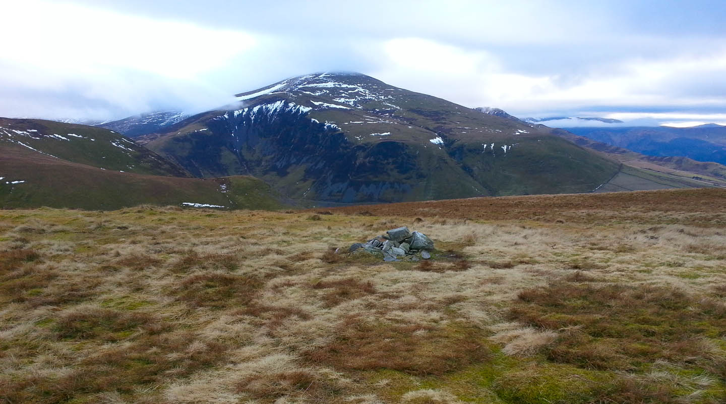
....than this one. But I trudged over both anyway.

And I'm glad I did because the height gave me a good view of a lovely sunburst which made me curse not having brought my SLR camera. I reckon I could have got a great shot of this scene with my good gear, though there is some impression of the view from this phone pic.

The last half mile takes in the charming compact summit of Little Cockup...


...where a direct descent could be taken back to the start of the bridleway I took at the outset, but I chose to deviate slightly over Orthwaite Bank and got another snap of the sunburst which seemed to hang around for ages.
I contrived to slip in the last fifty yards of the path and fall arse-over-tit getting all muddy in the process but otherwise uninjured.

Back at the Travellers Rest in Grasmere, Jocky was one knackered dog, after 12 miles and 7 Wainwrights.

Sunday, 3 February 2013
Base Brown and Kirk Fell
This weekend it was me and the missus fourteenth wedding anniversary, or as near as with the actual day being Thursday, and she demanded that we go up to the Lake District for a couple of days. She even said she would join me for a bit of walking.

The view from the path gets good almost immediately you get above the roof of the building below and improves with every step, widening dramatically after a couple of hundred feet. As the sky was so clear it was wonderful to keep stopping and just looking, although Jocky gets impatient with me when I stop and goes off patrolling with his nose hoovering the ground. It was funny seeing him trying to scramble up some of the icy sections, with his little legs a blur trying to get purchase. He’d already had me laughing earlier when we went into the Honister shop to get the parking ticket. While I paid, he had let himself out of the automatic doors somehow, and couldn’t get back in. I spent a couple of minutes searching the shop for him before I spotted him pressing his nose against the glass wondering why I was hunting around in the shop.

Clambering up to Grey Knotts he was as frisky as a pup, and when we topped the crag to begin to approach the summit he found a patch of untouched snow, now very firm and gritty with big ice crystals, but untrodden and sculpted with wind ripples. He ran around on this snow trying to plough with his nose and rolling around on his back thoroughly enjoying the sensation of the cold surface. I took a couple of pictures of him and we made a cursory inspection of the summit, agreed it hadn’t moved since last time and trod on towards the inevitably dull Brandreth. I can see how Grey Knotts deserves to be a Wainwright with its steep ascent, but the inclusion of Brandreth seems odd – it’s hardly a peak at all, and certainly wouldn’t merit a climb of its own were it not a natural stop off point on the way to Green Gable. However, it was new to Jocky, if not to me and he gets a tick. He also tried to beg a tuna fish sandwich from a family resting up on the rocks near the summit, but I called him away.

Brandreth does at least have a nice view down Ennerdale and once we were a little past it and close to Green Gable I was eying Base Brown and moaning about the descent necessary between it and Green Gable.

The valley separating Brandreth and Base Brown forms a wide corrie underneath Green Gable which is very steep and craggy in parts and requires the walker to climb around it quite close to its top, so it feels like a lot of up and down walking. In reality it’s not as bad as it looks and the boggy section in Blackmoor Pots, the depression before Base Brown, even failed to inconvenience me being as hard as iron in the cold conditions. In fact I found myself having to smash through some ice to give Jocky a drink as he was licking the snow – shortly afterwards we found ourselves at the top and sat down for a snack. The good thing about such cold is that you can sit on the ground without risking a wet bum, though I did put my waterproof coat on the ground for Jocky who curled up on it for a rest of a few minutes.

I had bought a sandwich, sausage roll and some chocolate for the walk, and foolishly left them at the B&B, so all we had to eat was a nutrigrain bar and a chocolate flapjack left in the rucksack from weeks ago. Nevertheless, with a bit of help from Jocky, they were soon despatched and twenty minutes later we were away to Green Gable, now deserted despite a throng visible in the distance when I’d sat down to snack on Base Brown.

I’d forgotten how steep and craggy Green Gable is on the Western side and it became clear I would have to approach Kirk Fell via a descent from Windy gap. Last time I crossed Windy gap I climbed Great Gable, so I’ve never been on the path down towards Moses trod, or indeed down Aaron Slack to StyHead tarn. The Western path is pretty difficult going with lots of loose scree, so I hate to think what Aaron Slack must be like as it’s very steep. At the foot of the path I met two chaps who asked my opinion on the route to Seatoller – I suggested either Aaron Slack, with care, or the route over Green Gable and down the north-western flank of Base Brown. They decided in the end there was still enough day light to climb Great Gable from Windy gap and I offered to give them a lift if they missed the bus at Seatoller – I knew I would be driving down that way at about 6pm when the last bus leaves Seatoller, so I wondered if I might see them again – I didn’t in the end so I suppose they either caught the bus or are still on Great Gable!
Haystacks from the approach to Kirk fell.

The path to Kirk fell is straightforward with a few undulations and a bit of a climb up the eastern aspect of the hill threatening you as it comes into view, but it’s not really the killer its western counterpart is reputed to be. That is visible from Wasdale as a poker straight, steep trudge and I recall Wainwright giving it mention as the steepest continuous ascent in Lakeland, which I can believe.
 With some frozen snow to avoid and a few rough bits it took about 20 minutes to get up onto the top of the Fell, although the first part of the plateau is about fifty metres lower than the official summit about half a kilometre further west.
During the ascent Jocky kept stopping to look at me in disgust as though I was slacking and should quicken up. He can be real sarcastic that dog can.
The real summit is quite good actually with a very decent wind shelter where a cairn might normally be. I had a short stop in there for a drink of water and change of gloves, and for once the wind shelter is high enough to shield one’s head and shoulders. Oddly, while I we were up there the wind was hardly noticeable, so I didn’t really need the shelter.

The view of the Scafells from the top is bound to be marvellous of course!

To return to Honister by Moses trod, via the old pump house ruins I needed to return off Kirk fell the way I came up, which isn’t as simple as it sounds. The one very obvious path coming up cannot be mistaken, but on the way down there must be five or six possible start points – whichever we chose, I got a great view of the majesty of Great Gable which even at 800 or so metres on Kirk fell still seems huge.

I consulted my GPS after about ten minutes and we were not exactly following the upward path back down until about half way when it gets clearer, and I recognised little stretches we’d ascended.

When we were about a hundred metres from the low point at Beck Head Jocky suddenly went “on point” having seen something and with effort I could just make out a couple sat down seemingly miles away with two dogs. As we continued our descent one of the dogs saw us and galloped over to meet us. This dog was a nice little black terrier and all the dogs all had a brief chat before we pressed on for the final walk back to the car at Honister. As we got a decent way along Moses trod, nearing the modern fence it crosses via a stile, I stopped to snap a pretty sky and we then hurried on as I hoped we could make the car before dark. I was forgetting the long track after the pump house ruins, with all its switchbacks and steepness, so despite getting a good pace going we arrived at the car in near darkness, on the borderline of head-torch territory. I stopped briefly to photograph the plaque commemorating the re-opening of the Honister Mine - I wasn't sure if the photo would work as I was only using my phone for pictures on this trip, but they seem to turned out OK overall. I'd missed the plaque the first time I used the track and at first I wondered if it marked the spot where the poor owner of the mine perished in his helicopter not too long back. Now I think of it, I seem to recall the accident was a bit further down. A terrible shame wherever it was.

The last section after the plaque is a gentler gradient than the switch-backs and I was grateful as my right knee was giving me some pain – no idea why as I’d not jarred it as far as I could remember. At the car, I was grateful it was still dry as the temperature was now falling and I made a very chilly quick change into ordinary day clothes. All in all a good walk with plenty of great views. Two more Wainwrights for me and five more for Jocky, who must be up to twenty or more now I suppose. Still ninety-five left for me to do, and they must be done by the end of July when I am fifty, so I am plotting and planning some longer circular walks to mop them up. I can see how Jocky and I might well be doing some wild camping this spring to get some extended ridge-routes in. Bring it on!
Leigh does walk with me sometimes, but draws the line at much more than five miles, so the current rush I am in to finish my first round of Wainwrights is not really compatible with her idea of a nice weekend. As I type this comment I am minded to admit that she is far from a soppy woman with no energy as she recently joined me for a walk up to Whin Rigg and Illgill Head above Wastwater. That walk turned out to be a tough proposition in the end as we decided to descend to the lake edge for the return leg and negotiate the “screes”. Had I realised what the scree route demanded I would have suggested against it, especially with two small dogs in tow. The rocks were wet and slippery and only prolonged concentration and patience prevented us from coming a cropper – those screes are very treacherous in places. I even had to pop one of our dogs, Tilly, in my rucksack for a mile or so as she was struggling and frightened by the big rocks. My other dog, Jock is a bit braver, but even he looked at me very nervously once or twice and needed lifting over nastier bits occasionally. I wouldn’t want a broken ankle any more than the next man, but I’d much prefer it to placing someone else in the same situation, so that fact that she managed the challenge is to her credit and she even mentions it with some satisfaction.
So, I was resigned to a shorter walk than I’d prefer, but still we set off late Friday afternoon for a B&B on the outskirts of Keswick, and arrived, despite some delays on the M6 at about 9pm. It was too late for any decent pub food or the like, but we grabbed some pie and chips in Keswick town centre and scoffed those in the car, and returned the B&B for a bottle of wine via a swift pint in a pub. You may be detecting a theme at this point!
Up nice and early for breakfast and the weather was, in my opinion, at its best for walking – crystal clear skies and bone-chilling cold. Leigh gave the dogs a five minute walk so they could have a wee, and then we began to prepare for the day. Unfortunately, she was a bit under the weather and suggested I might like to go up the fell alone. She would take a gentle stroll into town for a bit of light shopping, lunch and spend the afternoon lolling about in front of the iPad watching soaps. This met with my immediate approval and I soon set off with just Jock, leaving Tilly with Leigh to have a girls’ day in.
The arrangement opened up possibilities for me, and I realised I could mop up a couple of fells that have been nagging at my conscience for ages – Base Brown and Kirk Fell. In both cases I have walked pretty much everything near them leaving them in less than splendid isolation as unconquered peaks, and demanding special trips just to bag a single tick on the list. This is OK for some of the smaller “Oughts”, but a nuisance for bigger ones that could easily take half a day each.
It occurred to me that if I started a walk from Honister Pass I could do the pair as part of a circular walk and revisit a couple of previous conquests at the same time, so by about 10.30 I was changed booted and setting off up the steep path above the Honister café toward Grey Knotts. This path, running by a more or less straight fence is almost impossible to get lost on. In places it deviated from the fence for a few minutes to get round eroded parts or, as was the case this time, to avoid badly iced sections where folk have detoured year after year and made secondary paths. On the whole though it’s a good steady climb which makes height quickly and safely. 
The view from the path gets good almost immediately you get above the roof of the building below and improves with every step, widening dramatically after a couple of hundred feet. As the sky was so clear it was wonderful to keep stopping and just looking, although Jocky gets impatient with me when I stop and goes off patrolling with his nose hoovering the ground. It was funny seeing him trying to scramble up some of the icy sections, with his little legs a blur trying to get purchase. He’d already had me laughing earlier when we went into the Honister shop to get the parking ticket. While I paid, he had let himself out of the automatic doors somehow, and couldn’t get back in. I spent a couple of minutes searching the shop for him before I spotted him pressing his nose against the glass wondering why I was hunting around in the shop.

Clambering up to Grey Knotts he was as frisky as a pup, and when we topped the crag to begin to approach the summit he found a patch of untouched snow, now very firm and gritty with big ice crystals, but untrodden and sculpted with wind ripples. He ran around on this snow trying to plough with his nose and rolling around on his back thoroughly enjoying the sensation of the cold surface. I took a couple of pictures of him and we made a cursory inspection of the summit, agreed it hadn’t moved since last time and trod on towards the inevitably dull Brandreth. I can see how Grey Knotts deserves to be a Wainwright with its steep ascent, but the inclusion of Brandreth seems odd – it’s hardly a peak at all, and certainly wouldn’t merit a climb of its own were it not a natural stop off point on the way to Green Gable. However, it was new to Jocky, if not to me and he gets a tick. He also tried to beg a tuna fish sandwich from a family resting up on the rocks near the summit, but I called him away.

Brandreth does at least have a nice view down Ennerdale and once we were a little past it and close to Green Gable I was eying Base Brown and moaning about the descent necessary between it and Green Gable.

The valley separating Brandreth and Base Brown forms a wide corrie underneath Green Gable which is very steep and craggy in parts and requires the walker to climb around it quite close to its top, so it feels like a lot of up and down walking. In reality it’s not as bad as it looks and the boggy section in Blackmoor Pots, the depression before Base Brown, even failed to inconvenience me being as hard as iron in the cold conditions. In fact I found myself having to smash through some ice to give Jocky a drink as he was licking the snow – shortly afterwards we found ourselves at the top and sat down for a snack. The good thing about such cold is that you can sit on the ground without risking a wet bum, though I did put my waterproof coat on the ground for Jocky who curled up on it for a rest of a few minutes.

I had bought a sandwich, sausage roll and some chocolate for the walk, and foolishly left them at the B&B, so all we had to eat was a nutrigrain bar and a chocolate flapjack left in the rucksack from weeks ago. Nevertheless, with a bit of help from Jocky, they were soon despatched and twenty minutes later we were away to Green Gable, now deserted despite a throng visible in the distance when I’d sat down to snack on Base Brown.

I’d forgotten how steep and craggy Green Gable is on the Western side and it became clear I would have to approach Kirk Fell via a descent from Windy gap. Last time I crossed Windy gap I climbed Great Gable, so I’ve never been on the path down towards Moses trod, or indeed down Aaron Slack to StyHead tarn. The Western path is pretty difficult going with lots of loose scree, so I hate to think what Aaron Slack must be like as it’s very steep. At the foot of the path I met two chaps who asked my opinion on the route to Seatoller – I suggested either Aaron Slack, with care, or the route over Green Gable and down the north-western flank of Base Brown. They decided in the end there was still enough day light to climb Great Gable from Windy gap and I offered to give them a lift if they missed the bus at Seatoller – I knew I would be driving down that way at about 6pm when the last bus leaves Seatoller, so I wondered if I might see them again – I didn’t in the end so I suppose they either caught the bus or are still on Great Gable!
Haystacks from the approach to Kirk fell.

The path to Kirk fell is straightforward with a few undulations and a bit of a climb up the eastern aspect of the hill threatening you as it comes into view, but it’s not really the killer its western counterpart is reputed to be. That is visible from Wasdale as a poker straight, steep trudge and I recall Wainwright giving it mention as the steepest continuous ascent in Lakeland, which I can believe.
 With some frozen snow to avoid and a few rough bits it took about 20 minutes to get up onto the top of the Fell, although the first part of the plateau is about fifty metres lower than the official summit about half a kilometre further west.
During the ascent Jocky kept stopping to look at me in disgust as though I was slacking and should quicken up. He can be real sarcastic that dog can.
The real summit is quite good actually with a very decent wind shelter where a cairn might normally be. I had a short stop in there for a drink of water and change of gloves, and for once the wind shelter is high enough to shield one’s head and shoulders. Oddly, while I we were up there the wind was hardly noticeable, so I didn’t really need the shelter.

The view of the Scafells from the top is bound to be marvellous of course!

To return to Honister by Moses trod, via the old pump house ruins I needed to return off Kirk fell the way I came up, which isn’t as simple as it sounds. The one very obvious path coming up cannot be mistaken, but on the way down there must be five or six possible start points – whichever we chose, I got a great view of the majesty of Great Gable which even at 800 or so metres on Kirk fell still seems huge.

I consulted my GPS after about ten minutes and we were not exactly following the upward path back down until about half way when it gets clearer, and I recognised little stretches we’d ascended.

When we were about a hundred metres from the low point at Beck Head Jocky suddenly went “on point” having seen something and with effort I could just make out a couple sat down seemingly miles away with two dogs. As we continued our descent one of the dogs saw us and galloped over to meet us. This dog was a nice little black terrier and all the dogs all had a brief chat before we pressed on for the final walk back to the car at Honister. As we got a decent way along Moses trod, nearing the modern fence it crosses via a stile, I stopped to snap a pretty sky and we then hurried on as I hoped we could make the car before dark. I was forgetting the long track after the pump house ruins, with all its switchbacks and steepness, so despite getting a good pace going we arrived at the car in near darkness, on the borderline of head-torch territory. I stopped briefly to photograph the plaque commemorating the re-opening of the Honister Mine - I wasn't sure if the photo would work as I was only using my phone for pictures on this trip, but they seem to turned out OK overall. I'd missed the plaque the first time I used the track and at first I wondered if it marked the spot where the poor owner of the mine perished in his helicopter not too long back. Now I think of it, I seem to recall the accident was a bit further down. A terrible shame wherever it was.

The last section after the plaque is a gentler gradient than the switch-backs and I was grateful as my right knee was giving me some pain – no idea why as I’d not jarred it as far as I could remember. At the car, I was grateful it was still dry as the temperature was now falling and I made a very chilly quick change into ordinary day clothes. All in all a good walk with plenty of great views. Two more Wainwrights for me and five more for Jocky, who must be up to twenty or more now I suppose. Still ninety-five left for me to do, and they must be done by the end of July when I am fifty, so I am plotting and planning some longer circular walks to mop them up. I can see how Jocky and I might well be doing some wild camping this spring to get some extended ridge-routes in. Bring it on!
Subscribe to:
Posts (Atom)